Table 1 |
||||
LAND USE / LAND COVER CLASSIFICATION SYSTEM |
||||
Sl No. |
LEVEL - I |
LEVEL –II |
LEVEL - III |
LEVEL - IV |
1 |
BUILT UP LAND |
Built up(rural) |
Rural (Residential) |
|
Transportation |
Unmetalled road |
|
||
Metalled road |
|
|||
2 |
AGRICULTURAL LAND |
Cropland |
Irrigated Agriculture |
Paddy |
Vegetables |
||||
Dry land Agriculture |
Tubers* |
|||
Pulses/ Millets* |
||||
Cotton* |
||||
Red gram* |
||||
Other crops + scattered trees |
||||
Plantations |
Cashew |
|
||
Eucalyptus |
|
|||
Fallow |
Current fallow |
|
||
Long fallow* |
|
|||
3 |
FOREST |
Forest |
Dense forest |
|
Degraded forest |
|
|||
4 |
WASTE LAND |
Scrub |
Scrub along streams |
Scrub along streams |
Land with scrub |
Land with scrub |
|||
Degraded plantations with scrub |
Cashew dominant |
|||
Eucalyptus dominant |
||||
Salt affected |
Calcarious |
|
||
Stoney waste |
Sheet rock |
|
||
5 |
WATER BODIES |
Tank |
Tank |
|
6 |
OTHERS |
Tree |
Individual Trees |
Toddy, Tamarind, etc. |
|
* based on ground observation survey number wise |
|
|
|


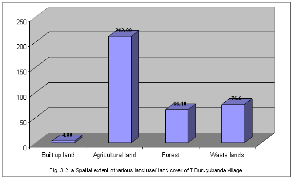
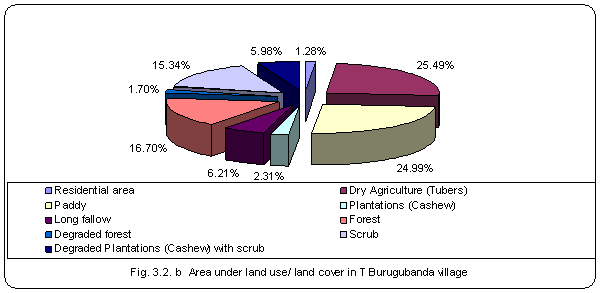
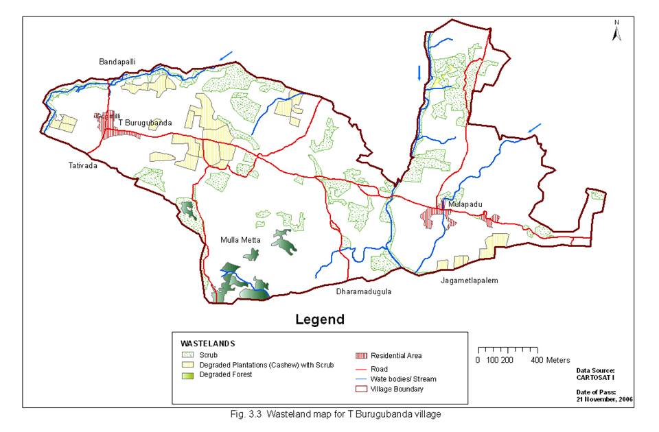
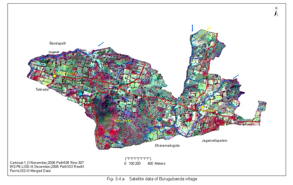
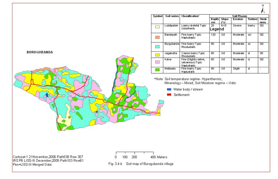
Table - 2: Spatial extent of various land use/ land cover of T Burugubanda village |
|||
Sl. No. |
LANDUSE |
AREA (IN Ha.) |
% TGA |
1 |
Built-up land |
|
|
1 |
Residential area |
4.60 |
1.28 |
|
|
4.60 |
1.28 |
2 |
Agricultural land |
|
|
1 |
Dry Agriculture (Tubers) |
91.60 |
25.49 |
2 |
Paddy |
89.80 |
24.99 |
3 |
Plantations (Cashew) |
8.30 |
2.31 |
4 |
Long fallow |
22.30 |
6.21 |
|
|
212.00 |
59.00 |
3 |
Forest |
|
|
1 |
Forest |
60.00 |
16.70 |
2 |
Degraded forest |
6.10 |
1.70 |
|
|
66.10 |
18.40 |
4 |
Waste lands |
|
|
1 |
Scrub |
55.10 |
15.34 |
2 |
Degraded Plantations (Cashew) with scrub |
21.50 |
5.98 |
|
|
76.60 |
21.32 |
5 |
Waterbodies |
|
|
1 |
Streams/ Tank |
|
|
|
|
|
|
|
TOTAL |
359.30 |
100.00 |
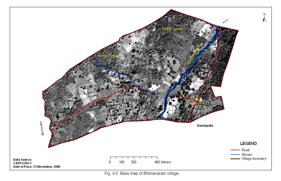
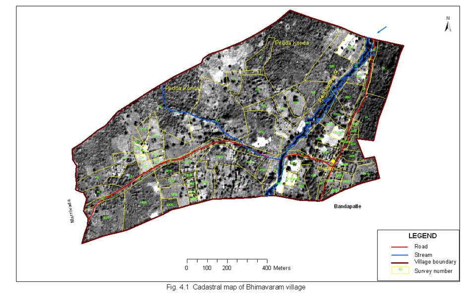
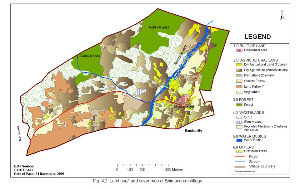
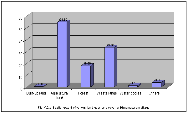
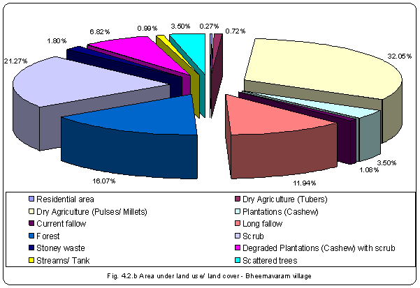
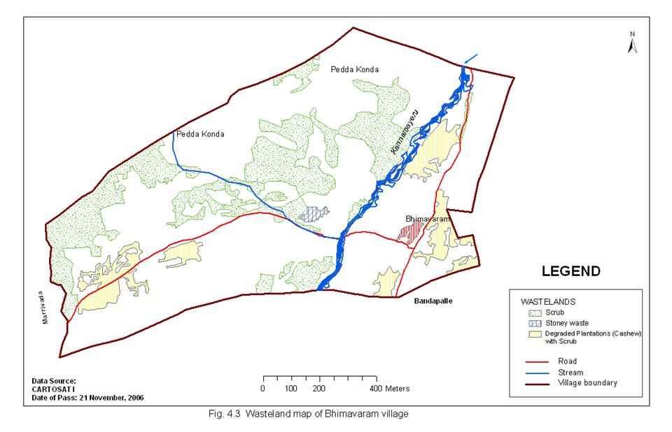
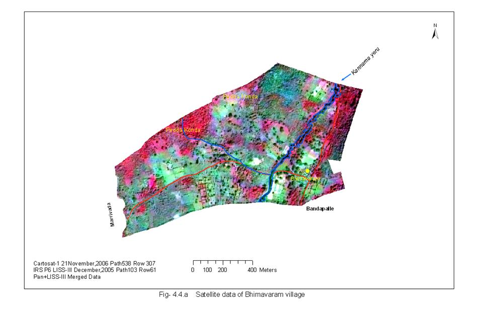
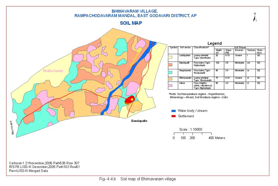
Table - 3: Spatial extent of various land use/ land cover of Bhimavaram village |
|||
Sl. No. |
LANDUSE |
AREA (IN Ha.) |
% TGA |
1 |
Built-up land |
|
|
1 |
Residential area |
0.30 |
0.28 |
|
|
0.30 |
0.28 |
2 |
Agricultural land |
|
|
1 |
Dry Agriculture (Tubers) |
0.80 |
0.74 |
2 |
Dry Agriculture (Pulses/ Millets) |
35.70 |
33.21 |
3 |
Plantations (Cashew) |
3.90 |
3.63 |
4 |
Current fallow |
1.20 |
1.12 |
5 |
Long fallow |
13.30 |
12.37 |
|
|
54.90 |
51.07 |
3 |
Forest |
|
|
1 |
Forest |
17.90 |
16.65 |
|
|
17.90 |
16.65 |
4 |
Waste lands |
|
|
1 |
Scrub |
23.70 |
22.05 |
2 |
Stoney waste |
2.00 |
1.86 |
3 |
Degraded Plantations (Cashew) with scrub |
7.60 |
7.07 |
|
|
33.30 |
30.98 |
5 |
Waterbodies |
|
|
1 |
Streams/ Tank |
1.10 |
1.02 |
|
|
1.10 |
1.02 |
6 |
Others |
|
|
1 |
Scattered trees |
3.90 |
3.63 |
|
|
3.90 |
3.63 |
|
|
|
|
|
TOTAL |
107.50 |
100.00 |
|
|
|
|
* TGA - Total Geographic Area |
|
|
|
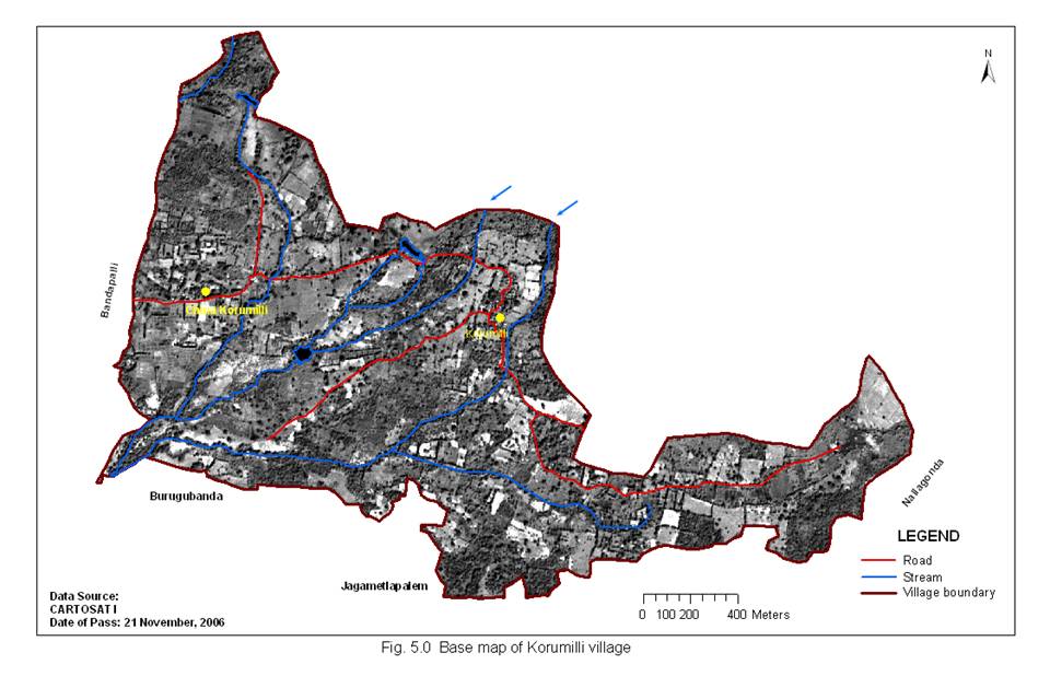
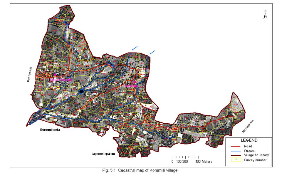
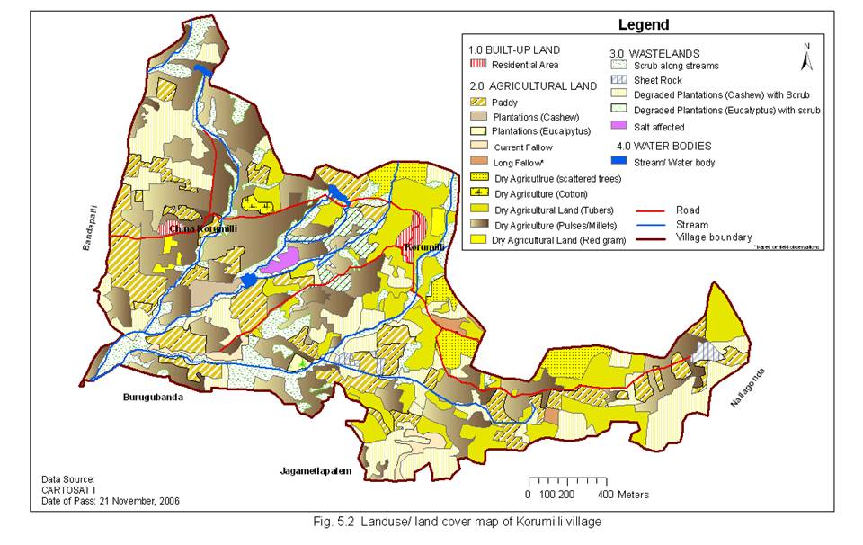
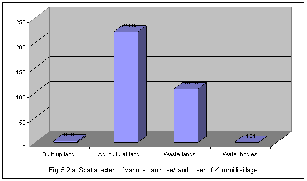
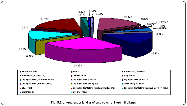
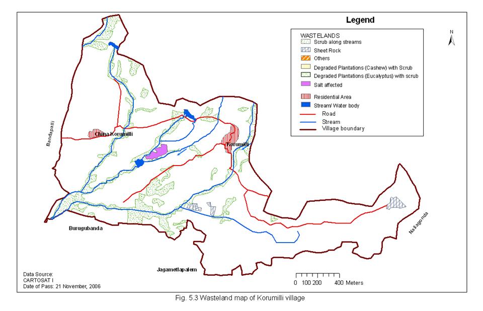
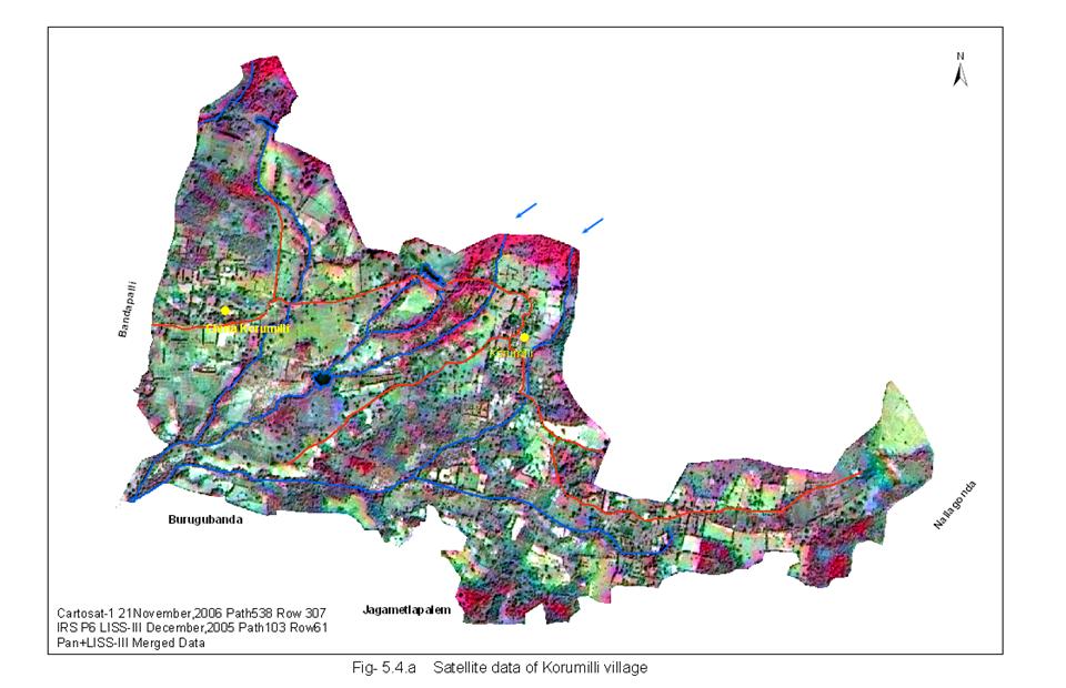
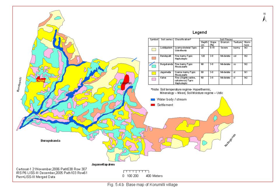
Table - 4: Spatial extent of various land use/ land cover of Korumilli village |
|||
Sl. No. |
LANDUSE |
AREA (IN Ha.) |
% TGA |
1 |
Built-up land |
|
|
1 |
Residential area |
3.09 |
0.93 |
|
|
3.09 |
0.93 |
2 |
Agricultural land |
|
|
1 |
Paddy |
51.94 |
15.60 |
2 |
Plantations (Cashew) |
2.31 |
0.71 |
3 |
Plantations (Eucalyptus) |
0.66 |
0.20 |
4 |
Current fallow |
3.55 |
1.07 |
5 |
Long fallow |
1.74 |
0.52 |
6 |
Dry Agriculture (Scattered trees) |
11.69 |
3.51 |
7 |
Dry Agriculture (Cotton) |
0.98 |
0.29 |
8 |
Dry Agriculture (Tubers) |
51.47 |
15.46 |
9 |
Dry Agriculture (Pulses/ Millets) |
95.31 |
28.63 |
10 |
Dry Agriculture (Redgram) |
1.97 |
0.59 |
|
|
221.62 |
66.58 |
4 |
Waste lands |
|
|
1 |
Scrub along streams |
39.91 |
11.99 |
2 |
Sheet rock |
2.14 |
0.64 |
3 |
Degraded Plantations (Cashew) with scrub |
57.20 |
17.18 |
4 |
Degraded Plantations (Eucalyptus) with scrub |
6.56 |
1.97 |
5 |
Salt affected |
1.35 |
0.41 |
|
|
107.16 |
32.19 |
5 |
Waterbodies |
|
|
1 |
Streams/ Tank |
1.01 |
0.30 |
|
|
1.01 |
0.30 |
|
TOTAL |
332.88 |
100.00 |
|
|
|
|
* TGA - Total Geographic Area |
|
|
|
Table 5 Extended soil legend |
||||
Map symbol |
Soil Mapping unit |
Description |
Land Capability sub-class |
Area (Ha) |
1 |
Lod-1-scl-d-e2 |
Loddipalem-series, Very shallow, gravelly sandy loam; moderately sloping (8-15%) (st3) with moderate erosion |
Ves |
47.76 |
2 |
Ban-6-scl-d-e3 |
Bandapalli-series, Deep, sandy clay loam, moderately sloping (8-15%) (st2) with severe erosion |
Ves |
13.03 |
3 |
Bur-5-sc-C-e2 |
Burugubanda- series, moderate deep, sandy clay, gently sloping (3-8%)(st3) moderate erosion |
IVes |
104.30 |
4 |
Tha-6-sl-C-e2 |
Thativada-series, Deep, sandy loam, gently sloping(3-8%)with moderate erosion |
IV es |
71.24 |
5 |
Gou-5-scl-d-e2 |
Gogumilli series, moderately deep, gravelly sandy clay loam, gently sloping (3-8%) (st3) with moderate erosion |
III es |
82.90 |
6 |
Mal-4-C-e2 |
Mulapadu- series, moderately shallow, silty clay, gently sloping (3-8%) with moderate erosion |
IIIes |
35.27 |
7 |
|
Water body/stream |
|
4.46 |
8 |
|
Settlements |
|
1.05 |
TABLE 6: SOIL CLASSES
Smu |
Physiography |
Soil Series |
Soil Classification |
Land Capability sub-class |
Area (Ha) |
1 |
Hill side slopes moderately dense vegetation |
Loddipalem-series |
Loamy skeletal Typic |
Ves |
47.76 |
2 |
Hill Foot slopes sparse vegetation |
Bandapalli- series |
Fine Loamy Typic |
Ves |
13.03 |
|
Undulating pdeiplain |
|
|
|
|
3 |
With scrub |
Burugubanda- series |
Fine loamyTypic Rhodustalfs |
IVes |
104.30 |
4 |
With out scrub |
Thativada-series |
Fine loamyTypic Haplustalfs |
IVes |
71.24 |
|
Intermontane valleys |
|
|
|
|
5 |
Uncultivate |
Gogumilli series-2 series |
Loamy skeletal Typic Haplustepts |
IIIes |
82.90 |
|
Buried pedi plain |
|
|
|
|
6 |
Gently sloping |
Mulapadu series |
Fine loamy Typic Halustalfsts |
IIIes |
35.27 |
7 |
Water body/ stream |
|
|
|
4.46 |
8 |
Settlements |
|
|
|
1.05 |
|
Total area |
360.01 |
|||